|
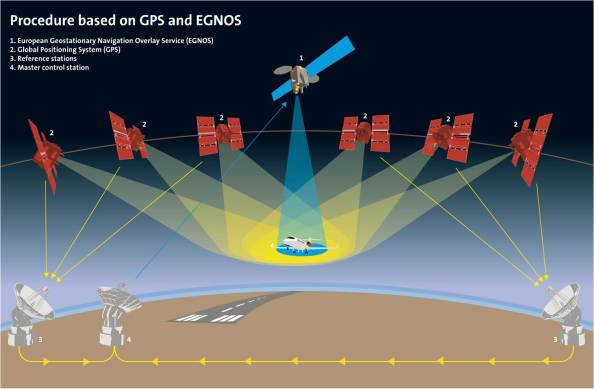
EGNOS uses GNSS measurements taken by
accurately located reference stations deployed across Europe.
All measured GNSS errors are transferred to a central computing
centre, where differential corrections and integrity messages
are calculated. These calculations are then broadcast over the
covered area using geostationary satellites that serve as an
augmentation, or overlay, to the original GNSS message.
|